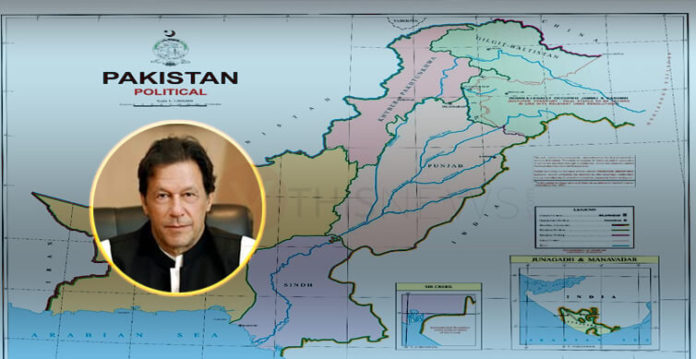
Pakistan’s Prime Minister Imran Khan recently disclosed a new map of Paksitan which showed the entire disputed region of Jammu and Kashmir as its territory.
The whole scenario was misinterpreted by majority of the nation. There were both, mean comments from opposition party and ignorant comments from people. Some past weak points and weak communication system of the government gave fuel to the burning fire.
This move was supposed to indicate that occupied Kashmir is an integral part of Pakistan but the whole situation rather turned into politicized discussion and the meaning was lost.
The Survey of Pakistan is the only national mapping and land surveying agency in Pakistan. SOP is, therefore, the only agency that can define and establish Pakistan’s international borders, carry out topographic surveys, prepare national geographical database and publish maps of Pakistan.
The minimal changes in the map are essential to be shown as a powerful narrative hence there is a need for clarified and standardized political map.
It holds importance as it might not be able to settle the on-going Kashmir dispute but this indicates that Pakistan rejects India’s forceful claim over Kashmir.


